Backpacking has always required two separate skills: surviving the trail and surviving the planning. AllTrails wants to kill the second one.
The company just announced an upgrade to its Peak membership tier; a suite of backpacking-specific tools designed to collapse what used to be a multi-tab, multi-hour planning session into a single workflow.
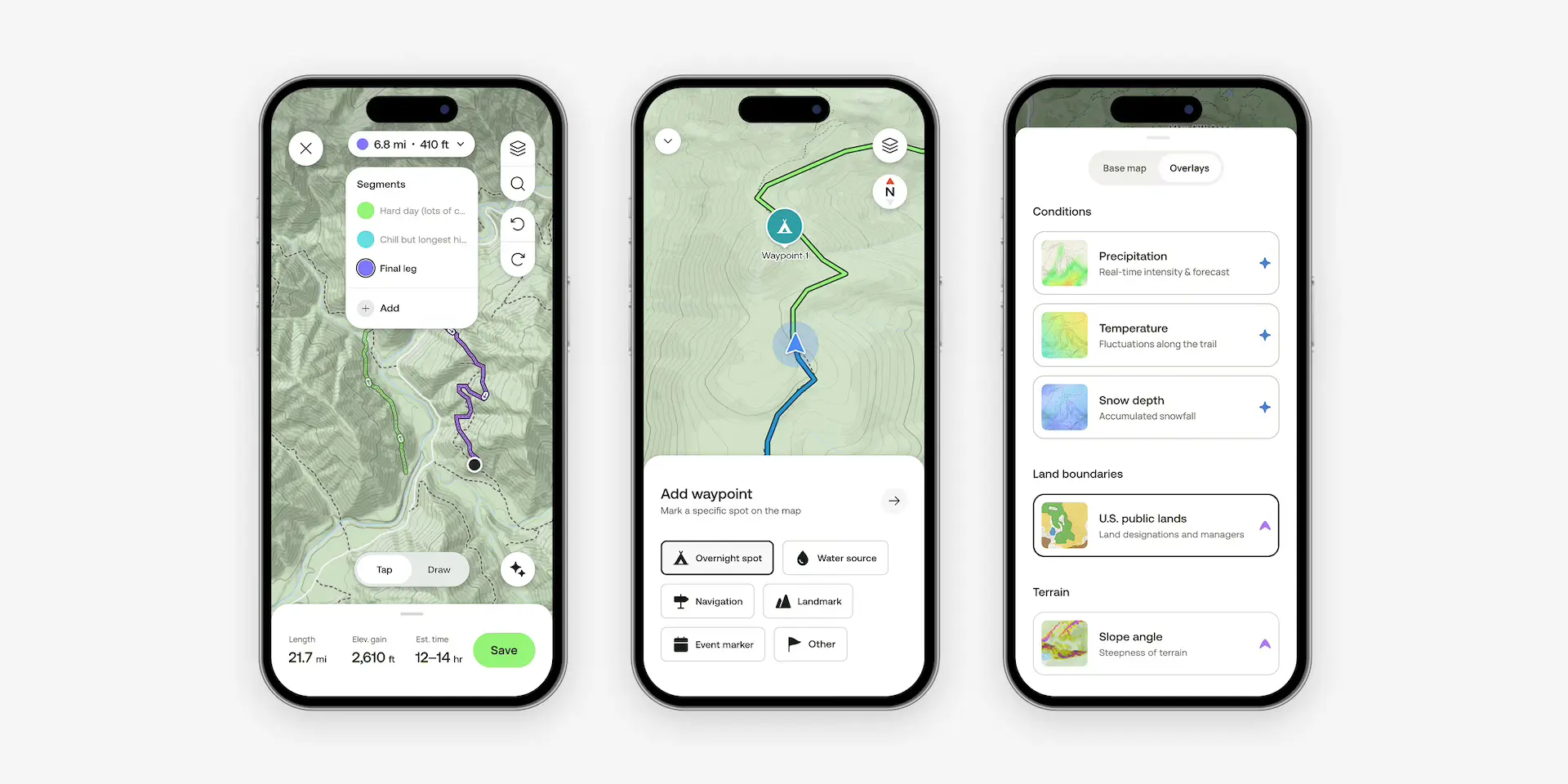
The headline feature is a route assistant that builds a day-by-day itinerary based on your preferences for elevation gain and daily mileage, then describes what you’re actually getting into each day before you ever leave the trailhead.
So its part planner, part assistant.
Reddit’s Role
And it all started, with a Reddit post.
AllTrails engineer Billy Yarosh, a backpacker himself stumbled across someone asking for the best multi-day route on Mt. Hood in Oregon. He knew from experience that the answer wasn’t simple, and that most people planning a trip like that were bouncing between AllTrails, Gaia, Caltopo, and a handful of browser tabs. So he and his team built the route assistant to fix that and the result is what AllTrails is calling its most ambitious backpacking feature to date.
What’s Actually New
Custom Routes with Segmentation — Available to all members on desktop and Peak members in the app, this lets you break a multi-day route into daily segments, drop in campsites, and track mileage per day. Build it from an existing AllTrails route or draw your own from scratch.
Route Assistant (Beta) — This is Peak-exclusive and currently on desktop and coming to mobile. Input your preferences and the assistant generates a smart itinerary with elevation context and daily summaries. It’s not just a mileage calculator but is designed to tell you what each day actually feels like.
Waypoints — Open to all members. Drop pins for water sources, resupply points, bail-out routes, and anything else worth marking. You can also view waypoints shared by the broader AllTrails community, which is useful on less-documented routes which may be on the scary side.
Map Overlays + Offline Navigation — Peak members get slope angle overlays and U.S. public lands data layered onto their maps. Download this for offline use, navigate without cell service, and print a full backup map with waypoints before you go.
All-in-all we’ll say this update is plenty maningful, especially if it is going to save us time. But also, it better work. There is nothing like going out in the wildnerness wondering if tech will push you forward or hold you back.
Planning any route through unknown terrain involves the same attention to elevation, pacing, and logistics as race prep. Tools that surface that information without requiring a mapping degree are worth it.
AllTrails Peak is $79.99 and AllTrails Plus is $35.99 annually. The route assistant is live now on desktop at alltrails.com/explore/custom-routes.
Leave a Reply
You must be logged in to post a comment.