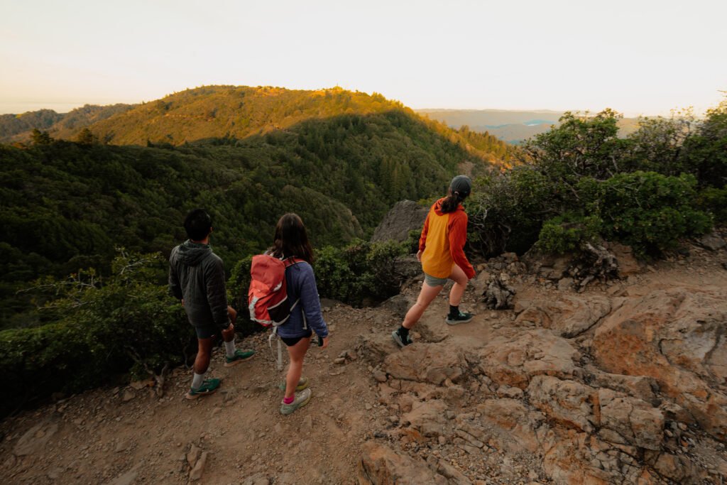
We love a good hike and depending on the distance or type, you can figure out a lot about life in just a few hours. You show up at the trailhead, bring your dog, drag a few friends along, and somewhere between the first climb and the summit view, you are feeling better about life.
But the data around hiking on Strava has been an after thought.
Until now.
Strava just announced a significant update to its hiking experience, adding a full suite of tools across route planning, real-time navigation, and social sharing.
Hiking Has Exploded
Before we get into the new features, let’s sit with the boom Strava has seen.
Hiking is an experience sport and Strava is saying, grouped hikes are 32% longer than solo hikes and include twice as much downtime during the activity which we love. Because if you’ve ever gone on a hike, the stoppage time, moments to take in the views, and the conversations in between is the whole point.
Women are more likely than men to log a hiking activity on Strava, and Gen X leads all generational cohorts in hiking frequency. Strava’s own Year In Sport data found that 2025 saw a 5.8x increase in hiking clubs on the platform. Whether that reflects a post-pandemic cultural shift, its cool to see a generation finally leaning into lower-impact outdoors activity, or maybe they just want to escape tech.
And if you want to know where people are actually going, here are the most popular hiking segments in the U.S. right now:
- Mist/Muir Intersection Down and Half Dome in Yosemite
- Arches Entrance Rd Climb at Arches National Park
- Angel base down to river at Zion
- Dream Lake to Bear Lake Downhill at Rocky Mountain National Park.
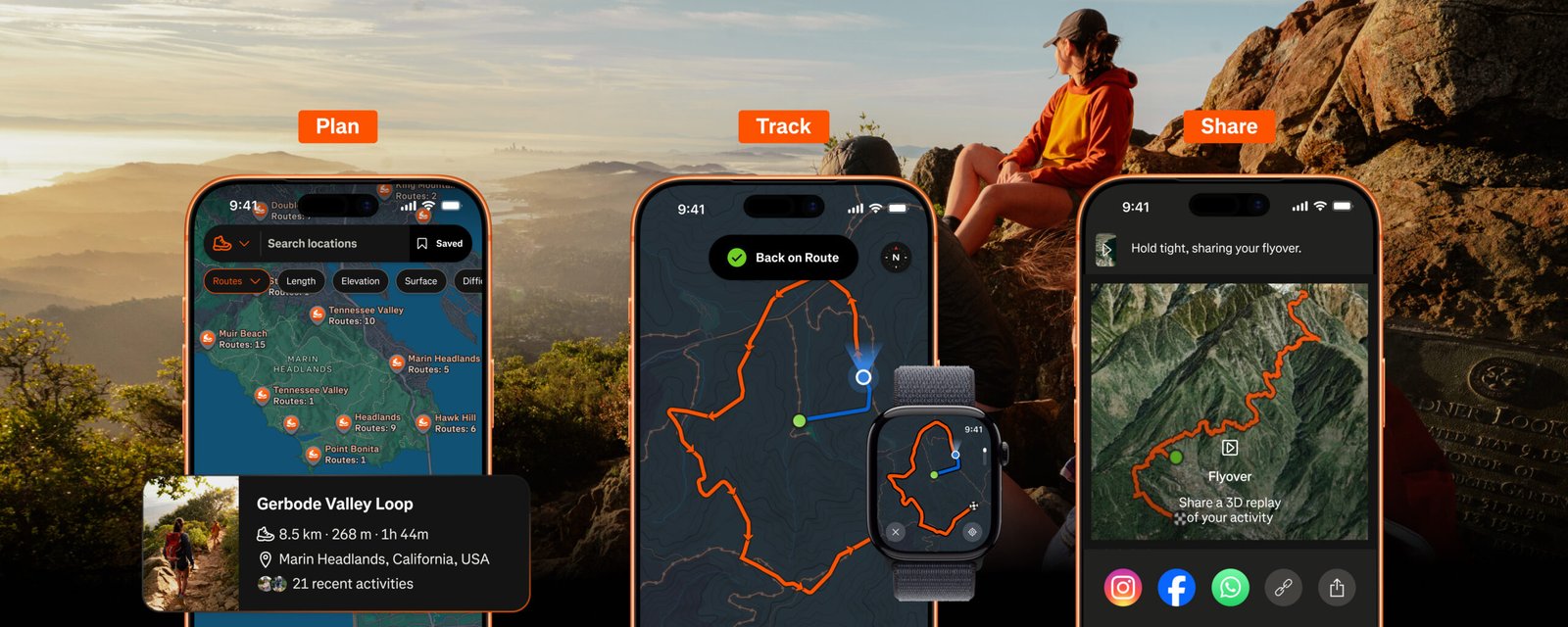
What Strava Actually Released
The update spans three phases of the hiking experience — before, during, and after.
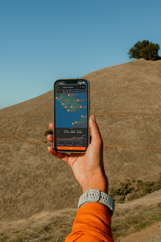
On the planning side, Strava is rolling out richer map visuals later this summer that will surface trail surfaces, trailhead markers, picnic areas, and campgrounds in a way that makes dense trail networks actually readable. Subscribers get Route Discovery (powered by the global heatmap), a full Route Builder with live elevation and surface feedback as you draw, and the new Route Saves feature — so you can bookmark routes from multiple places in the app and come back to them later.
On the trail, the standout addition is Off-Route Alerts, which notifies you when you’ve strayed from a planned path (HUGE!) before you’ve gone far enough to regret it.
Offline Routes lets you download your planned route for areas with no cell signal — which, if you’ve ever been navigating in a canyon with a spinning wheel where your map used to be, you’ll understand the value immediately.
Apple Watch navigation, Garmin sync, and Coros device integration round it out. Speaking of Coros: if you haven’t seen what they’ve been doing with trail navigation and outdoor tracking lately, we covered their AllTrails integration right here.
On the sharing side, Strava is leaning into the social fabric that makes hiking different from other endurance sports.
There’s a 3D Activity Map that renders your hike’s topography in your feed, Activity Replays that auto-animate your route for friends, and Flyover — a cinematic aerial rendering of your completed route that makes even a moderate Saturday hike look like a National Geographic segment.
No, none of that is performance data but instead all of it is designed to make hiking visible and shareable in a community that often skews toward pace and power numbers.
Our Thoughts

Strava is always good at data and paying attention to what’s popular and then acting on it. And with the outdoor space more active than it’s been in decades, they jumped on fixing up their hiking segment much like volunteers fix up a trail.
Speaking of. Trail infrastructure is under pressure, access conversations are getting louder, and the community is expanding well beyond road racing to more of an all-season and sport lifestyle.
This year, we talked about that pressure directly with Pitt Grewe from AllTrails — that interview is worth a read if you haven’t seen it — and the tension between growing trail demand and shrinking federal support for trail maintenance is real.
This week also brought a new data story from COROS and AllTrails, a natural fit — and it reinforces the same thing Strava’s numbers are showing: people are outside hiking, and they’re tracking it, and they want the tools to do it better. This is a win-win for everybody.
Strava’s hiking update is available now, with Map Style Improvements rolling out later this summer. Most navigation and sharing features require a Strava subscription.
Leave a Reply
You must be logged in to post a comment.